From Concept to Creation
Land Surveying
At Gardner Group Construction, we offer comprehensive land surveying services in Charlotte, NC, designed to provide accurate and reliable data for your construction and development projects. With over 25 years of collective experience in the industry, our team of skilled surveyors combines advanced technology with extensive expertise to deliver precise results. Whether you are embarking on a residential, commercial, or industrial project, our land surveying services ensure that you have the necessary information to proceed with confidence.
Why Choose Gardner Group Construction for Land Surveying?
Our commitment to accuracy and attention to detail sets us apart in the field of land surveying. We use state-of-the-art equipment and proven techniques to ensure that our surveys meet the highest standards of precision and reliability. Our team is dedicated to providing you with the data you need to make informed decisions and achieve successful project outcomes.
Benefits of Our Land Surveying Services:
Accurate Data
Our land surveys provide precise and reliable measurements that are crucial for the planning and execution of construction projects. Accurate data helps prevent errors and ensures compliance with legal and regulatory requirements.
Regulatory Compliance
We ensure that our surveys meet all local, state, and federal regulations. Our surveys are conducted in accordance with industry standards and provide the necessary documentation for permits and approvals.
Risk Mitigation
By identifying potential issues and providing detailed information about your land, our surveys help mitigate risks associated with construction and development. We help you avoid costly mistakes and ensure that your project is built on a solid foundation.
Enhanced Project Planning
Our surveys offer valuable insights that inform the design and planning phases of your project. Accurate topographical and boundary data helps in creating effective and efficient plans for your construction or development.
Professional Expertise
Our experienced surveyors bring a wealth of knowledge to every project. We use advanced surveying technology and techniques to deliver high-quality results and provide expert guidance throughout the process.
Features of Our Land Surveying Services:
- Boundary Surveys: We conduct boundary surveys to establish and confirm property lines, helping you avoid disputes and ensuring that your project stays within legal boundaries. Our boundary surveys are essential for property transfers, disputes, and development planning.
- Topographic Surveys: Our topographic surveys provide detailed information about the land's elevation and contours. This data is critical for designing and planning projects that require an understanding of the land's natural features.
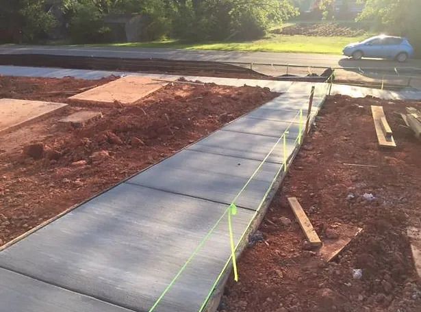
- Construction Surveys: We offer construction surveys to provide accurate data for the layout and positioning of structures. Our surveys help ensure that construction activities are aligned with design plans and specifications.
- ALTA/NSPS Surveys: We perform ALTA/NSPS land surveys to meet the standards required for commercial real estate transactions. These surveys provide detailed information on property boundaries, easements, and improvements.
- Subdivision Surveys: Our subdivision surveys are essential for dividing large parcels of land into smaller lots. We provide accurate measurements and legal descriptions to facilitate the creation of new property boundaries.
- Environmental Surveys: We conduct environmental surveys to assess the impact of construction or development on the surrounding environment. Our surveys help identify potential environmental concerns and ensure compliance with environmental regulations.
- As-Built Surveys: Our as-built surveys document the final construction and ensure that the completed project matches the original design and specifications. These surveys provide a record of the finished project and help with future maintenance and renovations.
- Floodplain Surveys: We offer floodplain surveys to determine the extent of flood zones on your property. This information is crucial for assessing flood risk and complying with floodplain management regulations.
Our Process
- Consultation: We begin with an initial consultation to understand your project needs and objectives. We discuss the scope of the survey, specific requirements, and any potential challenges.
- Site Assessment: Our team conducts a thorough site assessment to gather preliminary information and evaluate the land's characteristics. We use advanced surveying equipment to ensure accuracy.
- Survey Execution: We carry out the survey using state-of-the-art technology and techniques. Our surveyors collect data, measure distances, and map out property boundaries and topographical features.
- Data Analysis and Reporting: We analyze the collected data and prepare detailed reports and maps. Our reports include precise measurements, property boundaries, and any relevant findings.
- Review and Delivery: We review the survey results with you and provide comprehensive documentation. Our team is available to answer any questions and address any concerns you may have.
- Post-Survey Support: We offer post-survey support to assist with any follow-up needs. Our team is available to provide additional information or clarification as required.
Gardner Group Construction is committed to delivering exceptional land surveying services that provide the accurate and reliable data you need for your projects. Contact us today to discuss your surveying needs and learn how our expertise can support your construction or development efforts.
Contact Info
Locations
North Carolina office: 5234 Tuckaseegee Rd, Charlotte, NC 28208
South Carolina office: 10 Madeline Circle, Taylors, SC 29687
Georgia Office: 149 S McDonough St, Ste 270 Jonesboro, GA 30236